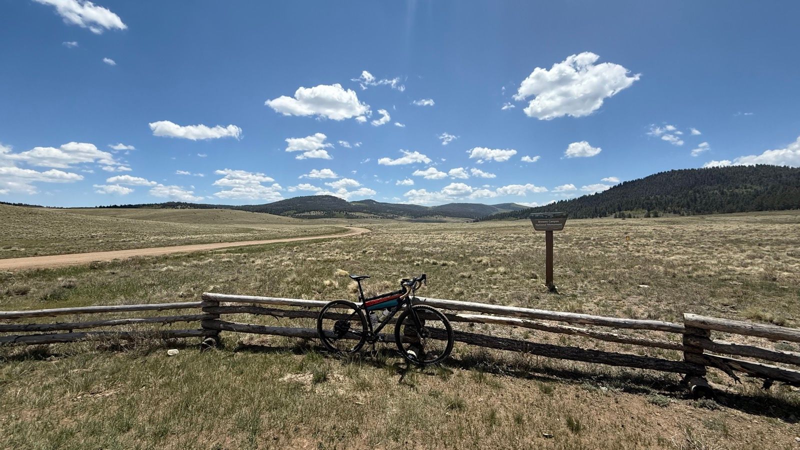
Is there anything more satisfying than finally nailing the saddle tilt on your curly bar bike? I say there is not, as it really does make riding so much more enjoyable.
And on the curly bar bike is where I’ve been spending time, since having a total hip replacement a little less than four weeks ago. With the weather getting warmer and the trails drying out I’d normally be mountain biking, but that’s off the table for me.
Rather than grouse around about not being able to mountain bike, I’m taking the opportunity to utilize the gravel bike for what it’s good for—exploring. And since my wife and all my friends are like me and would rather mountain bike, I’ve been riding alone a fair bit.
I have to say, exploring solo on the bike has been both fun and rewarding. I plotted out a 20-ish mile loop near BV, and got after it.
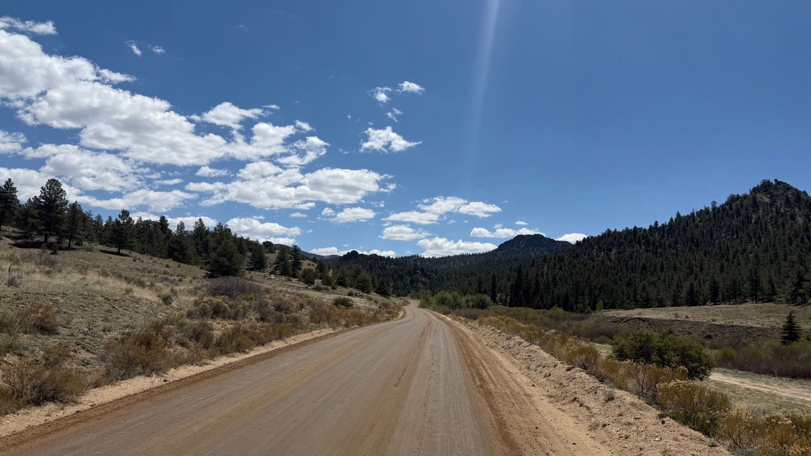
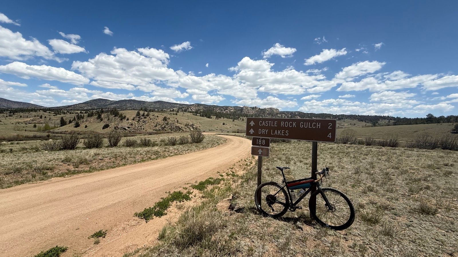
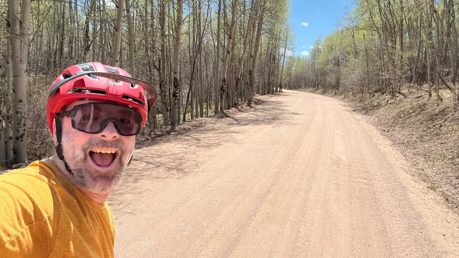
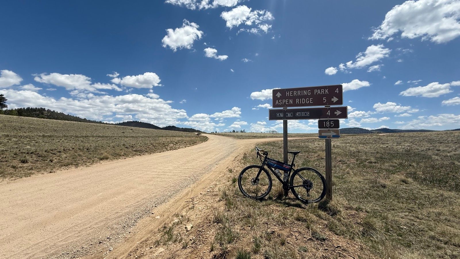
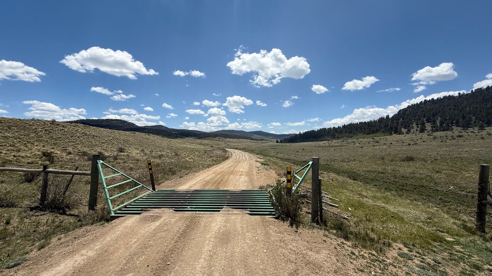
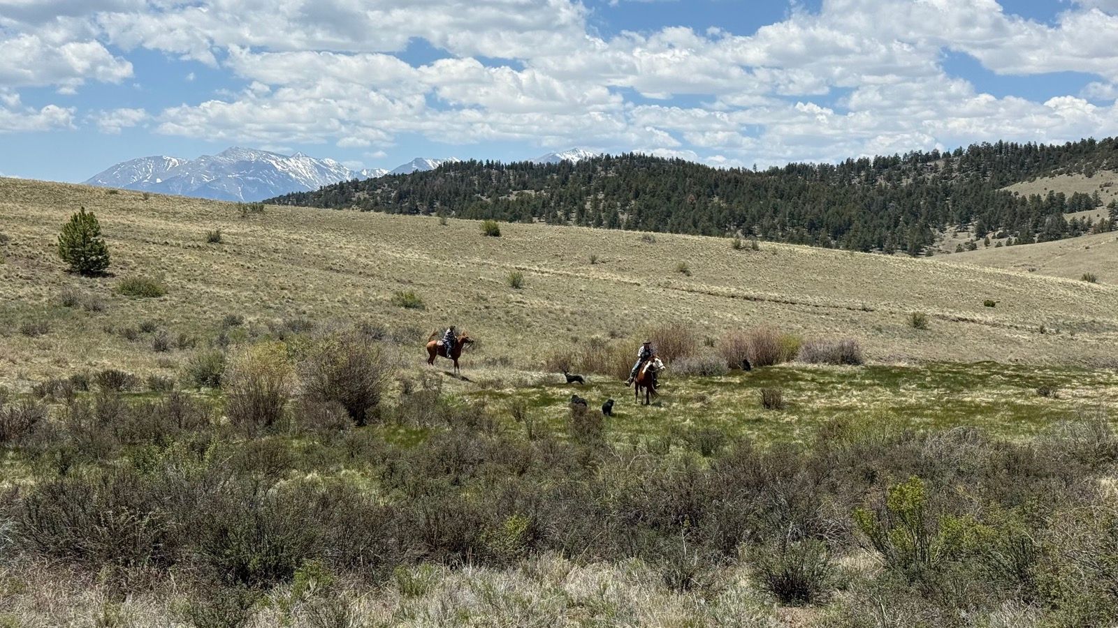
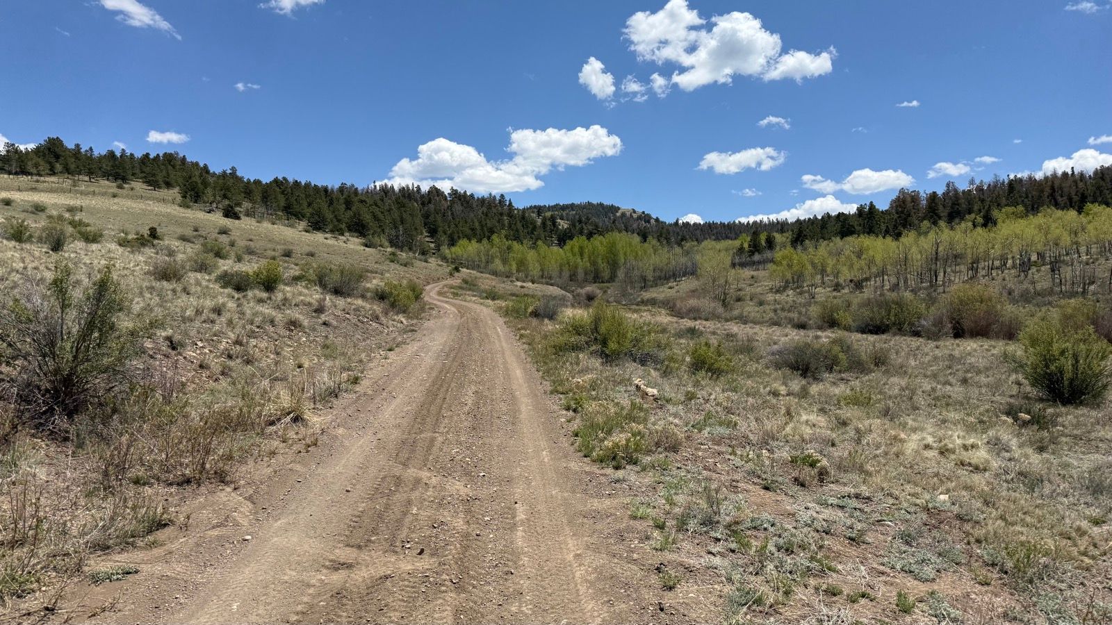
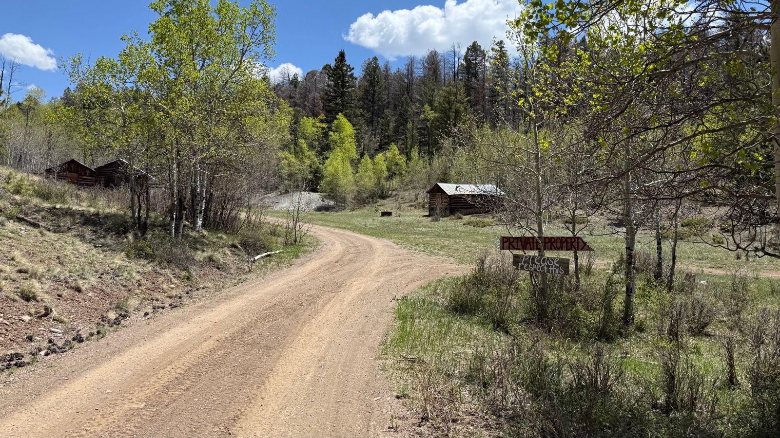
My ride started up Mushroom Gulch, just off HWY 285. The road was graded and wide, which would be the conditions for most of my day. The first section also had a healthy coating of mag chloride, which made it pretty fast.Saw some fauna on the way up, and throughout the ride. Sheep? Antelope? Uncle-ope? Hell, I don’t know. More graded dirt road, and gentle climbing grades. Exactly what a brand new hip less than a month old needs. I definitely saw some moto, ATV, and OHV traffic but not so much that it was an issue.This was the intersection I would return to. My route was a necktie, this spot is where I’d start going around the neck.Selfie while riding through an aspen grove. Super pretty! Part of my route would take me near Aspen Ridge, which is a pretty popular route from Salida to BV.I would turn right here, towards Aspen Ridge. Though I’d only be on CR185 for a little bit before turning off before getting on Aspen Ridge proper. Big open meadows with great vistas greeted me all along the route.I don’t know why, but I think cattle grates make neat pictures. Maybe because they frame the view for you? Just after turning off CR185 onto a more primitive dirt road, I saw these two folks on horseback. They had at least three dogs with them, maybe more. And one of the riders was yelling bloody murder at one of the dogs, who didn’t seem to be listening. Were they training a cattle dog? Unsure.The less maintained dirt road I had turned on to when I saw the horse folks. Still plenty rideable, but narrower, looser, and steeper. I think the plan was to turn left just in front of that rounded knob in the middle of the picture.I made it! This was kind of the goal of my ride, I saw this little spot on a map named Futurity, and wanted to have a look to see just what the heck it is. Futurity is apparently an old copper mine. There’s about 3-1/2 structures up there, three of which seem like they’ve had some restoration and are in decent shape. I didn’t stop long or try to poke around, due to the private property sign on the entrance road. Pretty neat to see, even if I couldn’t explore too much.The road I had mapped leaving Futurity had a bunch of logs thrown across it, which I summarily ignored as the road was a mapped and numbered USFS or county road according to the map. What I learned when plotting the route was that the road ended, but that a connector trail existed at the end of it which connected to another county road.
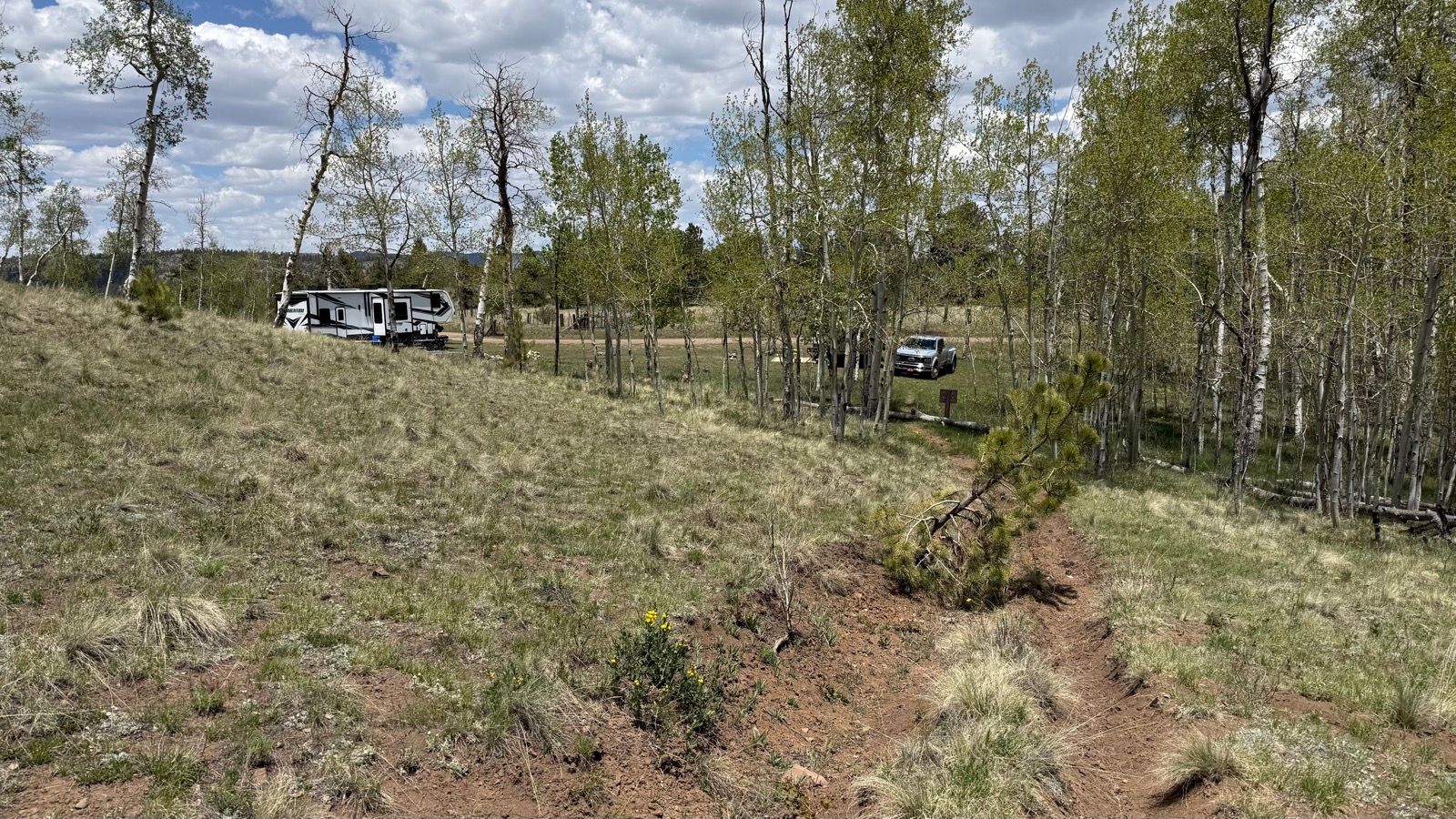
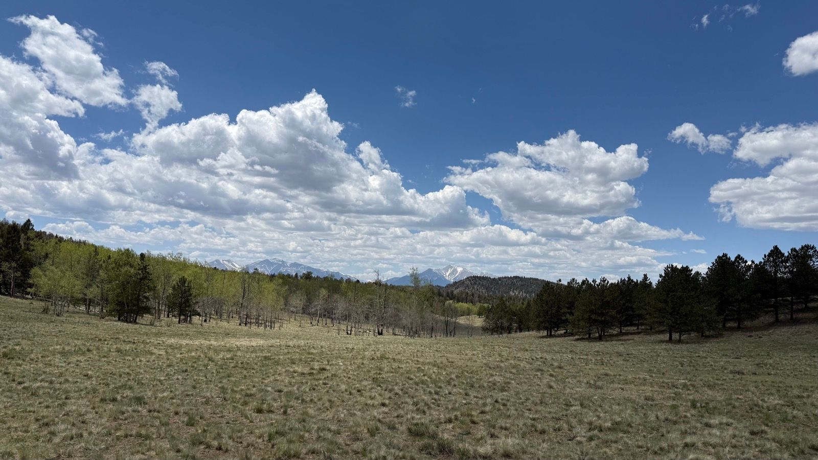
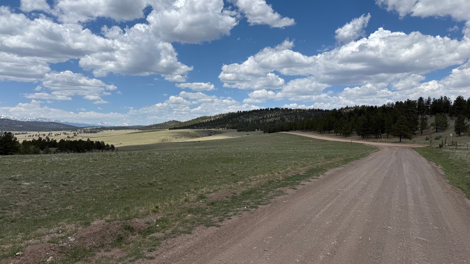
However, a bit of additional research using heat maps of cycling activity in the area revealed a fair bit of traffic on an unmapped something-or-other spurring off to the ENE. That unmapped something-or-other turned out to be an extremely primitive singletrack that took me up and over a saddle to connect with the county road I’d return on. In my defense, when I began my ride I stopped at a map kiosk which did have this trail marked as Elk 2, so I was pretty confident in it’s existence.When I popped out of Elk2, I was a bit surprised to not be at all surprised there were folks camping there. I saw a lot of really great campsites along this ride. It’s a beautiful area with loads of ATV and moto accessible roads, perfect for folks into that type of activity. Also perfect for gravel riding!Another big meadow view with Antero (L) and Princeton (R) in the distance. At least, I’m pretty sure that’s what mountains those are.Same spot, looking more to the north. My route would take me to the right, a winding dirt road that descended through a bunch of really pretty forest. Didn’t stop to get many pictures as I was moving along at a pretty good clip.Nearing the bottom of the descent, I started seeing all of these neat rock formations. They reminded me of what petrified sand castles might look like, just rock blobs on top of rock blobs.And right as I was about to finish my necktie and connect with the road back out, I rode past this super pretty little pond. There were a couple of guys fishing there, I stopped and chatted a bit. They were pretty sure there weren’t any fish in that pond, but they kept trying. I suspect the “fishing” was just an excuse to drink beer at noon, but what do I know?
Oh, and to the guy in the fully kitted-out Rubicon overlander, you know there’s a Prius with a mailbox on the bumper and a bald front tire up here, right?